Mt. Blackburn
Mount Blackburn (16,390ft)
Route Elevation Gain: 9,400ft
North/North West Ridge Grade: AI 3, Steep Snow, AK Grade II - May 30, 1958 Bruce Gilbert, Dick Wahlstrom, Hans Gmoser, Adolf Bitterlich, and Leon Blumer
Season: May-July
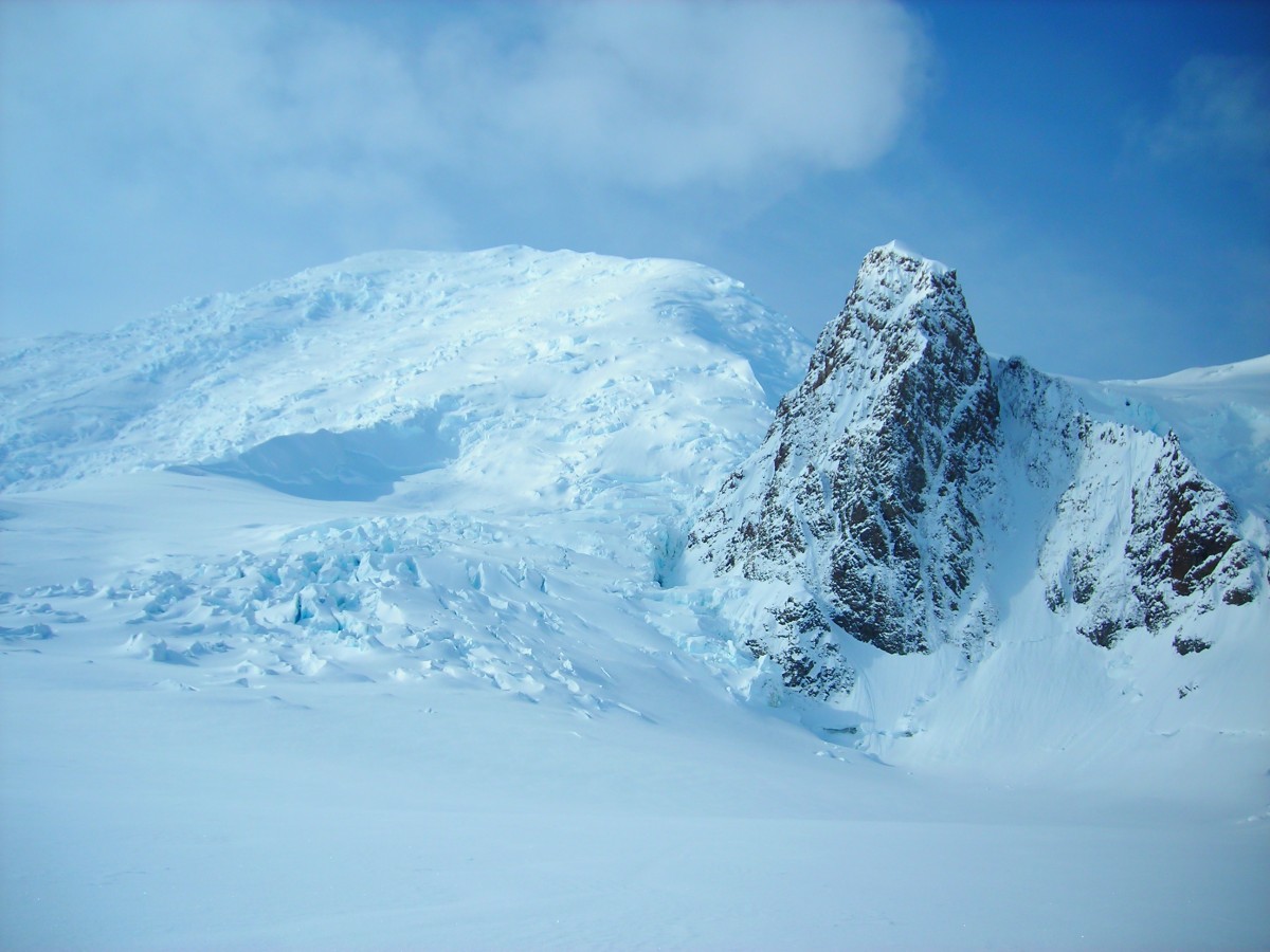
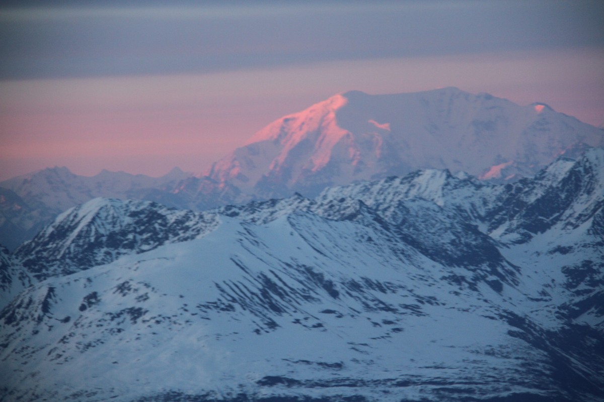
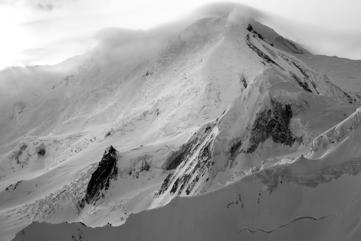
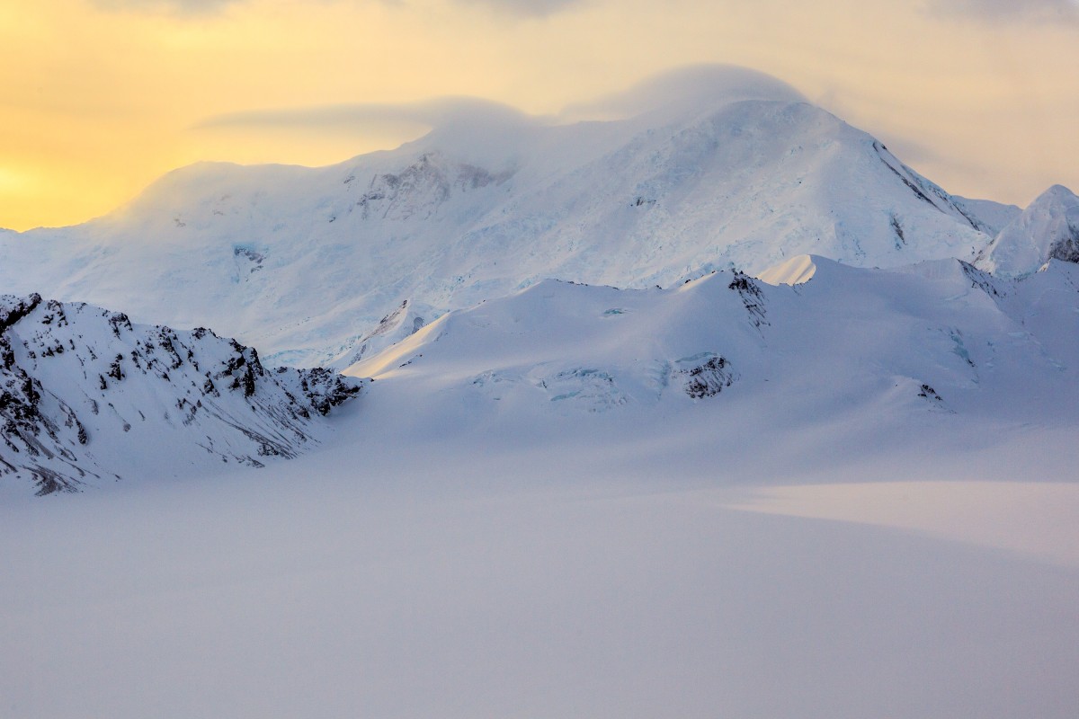
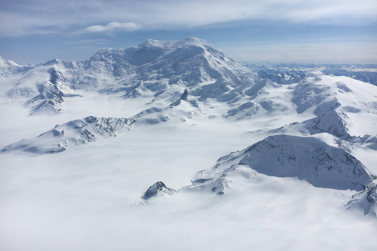
At 16,390ft, Mount Blackburn is the crown jewel of the Wrangell Mountains. The peak is
heavily guarded by large icefalls and heavily crevassed glaciers. Along with its height and location, the
peak is a magnet for adverse weather.
Mount Blackburn has colorful history. The "first ascent" of the east peak or Kennedy Peak, which is a few
hundred feet shorter than the west peak, was first climbed in 1912 by an expedition led by Dora Keen.
Dora Keen and party used dog sleds to travel 30 miles up the Kennicott Glacier from the copper mine of
Kennicott. They ascended the south-central icefall over the course of 30 days, to accomplish one of the
greatest mountaineering objectives in that era. At the time of Dora Keens ascent, the true summit
elevation of Mount Blackburn was unknown. This route out of the Kennicott Glacier is no longer doable
due to climate change.
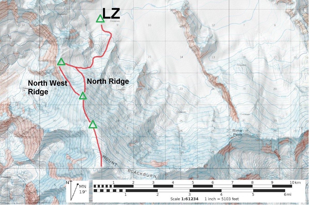
Route Description: The standard skiplane LZ is at approximately 7,000ft on the Nabesna Glacier at the
base of the mountain. There is a LZ at 9,500ft, but that is cheating! This area is at the head of the largest
interior valley glacier on the continent, so be prepared for some weather.
The crux of the route may be getting from 7,500ft to 9,500ft. This section ascends an ice fall with monster
crevasses and is exposed to avalanches and serac fall strafing down the 7,000ft north face of Mount
Blackburn.
A safe camp can be made on the western edge of the basin at 9,500+ft. You can get cell service from
here with a ski pole and some tin foil.
There are two variations to reach 12,500ft; the NW Ridge and the N Ridge. The NW Ridge is more wind
scoured and contains a short section of AI 2-3 for a couple hundred feet. The N Ridge is heavily wind
loaded with steep snow climbing and many bergshrunds and crevasses to navigate.
There are a few spots to bivy and camp along the way, 12,500ft and 15,000ft are your best options.
The ridge above 12,500 is straight forward with nice exposure.